(source: Strukton int. sharepoint news site)
A year ago, the Track Joint Venture [TJV] completed around 3.9 km of single track slab across line 4 and 6. At the end of September this year, TJV has progressed up to around 58.7 km with all work fronts and key activities ongoing. Now the temperature has finally dropped, these activities do also include final shimming and de-stressing of the running rails.
At 5 simultaneously running work area's (mainline 4, 5 and 6 and depot 4/6 and 5), a total workforce of around 1300 workers and staff are performing 20 out of 24 hours, almost 6 to 7 days a week. These efforts, combined with collaboration and good teamwork, have resulted in a significant contribution by TJV for this challenging mega project.
The first half of 2017 has been turbulent and challenging by adjusting schedules, project- and design document approvals, merging construction windows, optimizing work methods and a continuously increase of resources across the whole spectrum. Nowadays, TJV is cruising at a more consistent production rate in line with the schedules and substantial completion is expected for August 2018.
Next month, TJV will reach peak production and will be capable of constructing around 10 to11 km of completed trackslab per month including 3rd rail and cable ducts. With this construction rate, the FAST Consortium will stay at pole position compared to the other Consortia and during next month the halfway point will be crossed.
HSE and Quality performance is also at an acceptable level which is remarkable when taking into account the fact that track geometry specifications are similar to High Speed Lines (+/- 2MM tolerance on track gauge).
This significant progress has been recognized by all internal and external stakeholders and is also boosting confidence that TJV will deliver successfully her scope of work. Therefore the overall outlook for TJV is positive but close progress monitoring is paramount as potential delays from other Entities will have adverse impact on overall progress.
An important project milestone was due for 12th of October and has been successfully achieved by TJV. The infrastructure for the test track at depot 4/6, including access from the stabling building, has been completed. Tracks and 3rd/Conductor Rail are now available for TSY to install and test rail systems such as signalling, power supply and scada. With this milestone achieved, the project is on schedule to start test runs with trains in automated modus beginning of December.
Another key milestone is due for 18th of October to deliver the infrastructure to shunt and store trains at the end of line 4. Based on current progress trains can be shunted via one track from Depot 4/6 to station 4G1 and stored on temporarily track behind this station. The second track is on schedule to deliver at the end of October. The infrastructure between Depot 4/6 and station 4G1 is crucial scope for the overall project progress as this section is related to the first contractual Partial Trail Run milestone (planned commencement date October 2018). During this period, trains will be fully operated, without passengers, to demonstrate a safe and functional transport system to the Client.
A next milestone update will follow during December when paving works is due for completion at line 5.
Well done to everyone involved and keep up the good work as a Team!
(Red: Sander Hagenbeek)
zondag 22 oktober 2017
dinsdag 10 oktober 2017
Medain Salih (Little Petra) and the road to iT

eerste stop


sunrise at the petrol station


Good team


Car photo shoots in the morning


Just at sun rise


second pee stop at a construction site


second petrol stop

desolated

15 minutes later, air filter full of sand


even more desolated


mountains of only rock and sand


3rd (pee) stop


mirror picture

cooling the tyre

Lonely mosque


same team, different position


really empty road


after 1000 km drive

we reached Elephant mountain

they say it looks like a elephant (the mountain)


quite huge by the way

we left the Elephant and went for.....


Medain Salih (little Petra)


The Qur’an places settlement of the area by the Thamudi people during the days of Saleh, between those of Nuh (Noah) and Hud on one hand, and those of Ibrahim (Abraham) and Musa (Moses) on the other. According to the Islamic text, the Thamudis were punished by Allah for their practice of idol worship, being struck by an earthquake and lightning blasts. Thus, the site has earned a reputation as a cursed place an image which the national government is attempting to overcome as it seeks to develop Mada'in Saleh for its potential for tourism.
In 2008 UNESCO proclaimed Madaʼin Saleh as a site of patrimony, becoming Saudi Arabia's first World Heritage Site. It was chosen for its well-preserved remains from late antiquity, especially the 131 rock-cut monumental tombs, with their elaborately ornamented façades, of the Nabatean kingdom.


Its long history and the multitude of cultures occupying the site have produced several names. References by Strabo and other Mediterranean writers use the name Hegra for the Nabatean site.[9] The current name refers to the Islamic Nabi Salih. The name Al-Hijr : The Stoneland" or "The Rocky Place"),[has also been used to allude to its topography


The archaeological site of Mada’in Saleh is situated 20 km (12.4 mi) north of the town of Al-`Ula, 400 km (248.5 mi) north-west of Medina, and 500 km (310.7 mi) south-east of Petra, Jordan. The site is on a plain, at the foot of a basalt plateau, which forms a portion of the Hijaz mountains. The western and north-western portions of the site contain a water table that can be reached at a depth of 20 m (65.6 ft). The setting is notable for its desert landscape, marked by sandstone outcrops of various sizes and heights.


Nabatean era
At the crossroad of commerce, the Nabatean kingdom flourished, holding a monopoly for the trade of incense, myrrh and spices. Situated on the overland caravan route and connected to the Red Sea port of Egra Kome, Mada’in Saleh, then referred to as Hegra among the Nabateans, reached its peak as the major staging post on the main north–south trade route


Roman era
In 106 AD, the Nabatean kingdom was annexed by the contemporary Roman Empire. The Hejaz, which encompasses Hegra, became part of the Roman province of Arabia.The Hedjaz region was integrated into the Roman province of Arabia in 106 AD. A monumental Roman epigraph of 175-177 AD was recently discovered at al-Hijr (then called "Hegra" and now Mada'in Saleh).The trading itinerary shifted from the overland north–south axis on the Arabian Peninsula to the maritime route through the Red Sea. Thus, Hegra as a center of trade began to decline, leading to its abandonment.[18] Supported by the lack of later developments based on archaeological studies, experts have hypothesized that the site had lost all of its urban functions beginning in the late Antiquity (mainly due to the process of desertification).[10] Recently evidence has been discovered that the Roman legions of Trajan occupied Mada’in Salih in northeastern Arabia, increasing the extension of the "Arabia Petraea" province of the Romans in Arabia.[19]
The history of Hegra, from the decline of the Roman Empire until the emergence of Islam in the days of Muhammad, remains unknown.[18] It was only sporadically mentioned by travelers and pilgrims making their way to Mecca in the succeeding centuries.[14] Hegra served as a station along the Hajj route, providing supplies and water for pilgrims.[18] Among the accounts is a description made by 14th-century traveler Ibn Battuta, noting the red stone-cut tombs of Hegra, by then known as "al-Hijr."[10] However, he made no mention of human activities there.


Ottoman era
The Ottoman Empire annexed western Arabia from the Mamluks by 1517.[20] In early Ottoman accounts of the Hajj road between Damascus and Mecca, Mada’in Saleh is not mentioned, until 1672, when the Turkish traveler, Evliya Celebi noted that the caravan passed through a place called "Abyar Saleh" where there were the remains of seven cities.[21] It is again mentioned by the traveler Murtada ibn 'Alawan as a rest stop on the route called "al-Mada’in."[21] Between 1744 and 1757,[10][14] a fort was built at al-Hijr on the orders of the Ottoman governor of Damascus, As'ad Pasha al-Azm.[21] A cistern supplied by a large well within the fort was also built, and the site served as a one-day stop for Hajj pilgrims where they could purchase goods such as dates, lemons and oranges.[21] It was part of a series of fortifications built to protect the pilgrimage route to Mecca.[21]


19th Century
Following the discovery of Petra by the Swiss explorer Johann Ludwig Burckhardt in 1812, Charles Montagu Doughty, an English traveler, heard of a similar site near Mada'in Saleh, a fortified Ottoman town on the Hajj road from Damascus. In order to access the site, Doughty joined the Hajj caravan, and reached the site of the ruins in 1876, recording the visit in his journal which was published as Travels in Arabia Deserta.[14][18] Doughty described the Ottoman fort, where he resided for two months, and noted that Bedouin tribesmen had a permanent encampment just outside of the building.[21]
In the 19th Century, there were accounts that the extant wells and oasis agriculture of al-Hijr were being periodically used by settlers from the nearby village of Tayma.[14][18] This continued until the 20th century, when the Hejaz Railway that passed through the site was constructed (1901–08) on the orders of Ottoman sultan Abdul Hamid II to link Damascus and Jerusalem in the north-west with Medina and Mecca,[14][18] hence facilitating the pilgrimage journey to the latter and to politically and economically consolidate the Ottoman administration of the centers of Islamic faith.[22] A station was built north of al-Hijr for the maintenance of locomotives, and offices and dormitories for railroad staff.[14] The railway provided greater accessibility to the site. However, this was destroyed in a local revolt during World War I.[23] Despite this, several archaeological investigations continued to be conducted in the site beginning in the World War I period to the establishment of the Kingdom of Saudi Arabia in the 1930s up to the 1960s.[10][24] The railway station has also been restored and now includes 16 buildings and several pieces of rolling stock.[25]By the end of the 1960s, the Saudi Arabian government devised a program to introduce a sedentary lifestyle to the nomadic Bedouin tribes inhabiting the area.[10] It was proposed that they settle down on al-Hijr, re-using the already existent wells and agricultural features of the site.[10] However, the official identification of al-Hijr as an archaeological site in 1972 led to the resettlement of the Bedouins towards the north, beyond the site boundary.[10] This also included the development of new agricultural land and freshly dug wells, thereby preserving the state of al-Hijr.


Hoog en ver gezichten / beautiful sceneries

Indians watching over the valley


Mountain leaders


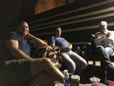
Our base camp for the night


after a long day it is a good rest

Arabic coffee, tea

and nuts


Sunset down


Lights enlighted


Two bedroom hotel room

with a lamp


the moon attend as well


dinner room and buffet

dinner promised at 7pm, became of course 8pm

Mixed grill, Humus, bread, drinks

to applause for

We were hungry after a long journey and many beautiful spots

after dinner
some coffee, tea or cola +


upcoming moon


sunset
and
sunrise


Ontbijt (niet heel geweldig maar het vult)


zandweg naar het kamp

bakkie onderweg


prima snelwegen die schoon zijn


ongevalletje (zoals zo velen)


het kamp

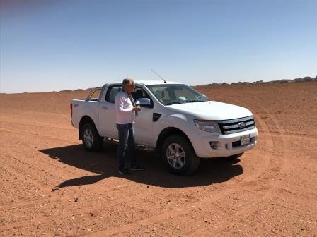
aangekomen en een zachte band. Pompen dus

na 1.000 km even bij komen in het kamp

de volgende dag naar de rots woningen


Moorkop?


groots en hoog


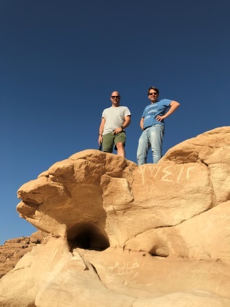
Rens en Sandor


Hoge instap

Marco Verbaten (heel alleen verlaten)


ja ik ben thuis........

Elephant Rock


je snapt het niet he ? een olifant?

heel groot


weer Rens en Sandor


weer terug naar Riyadh ( nee foto is opposite)
Abonneren op:
Reacties (Atom)